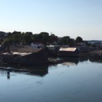
Early a.m. drop-off at the Lubec School, followed by a bus ride to today’s marathon start at Quoddy Head State Park. Lighthouse & an ocean view. All smiles.
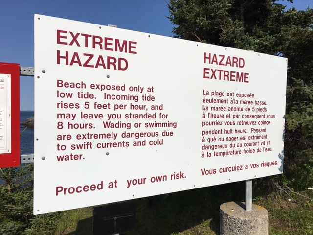
Temps would surpass mid-80°F by marathon end – summer marathoning norm, even in Canada.
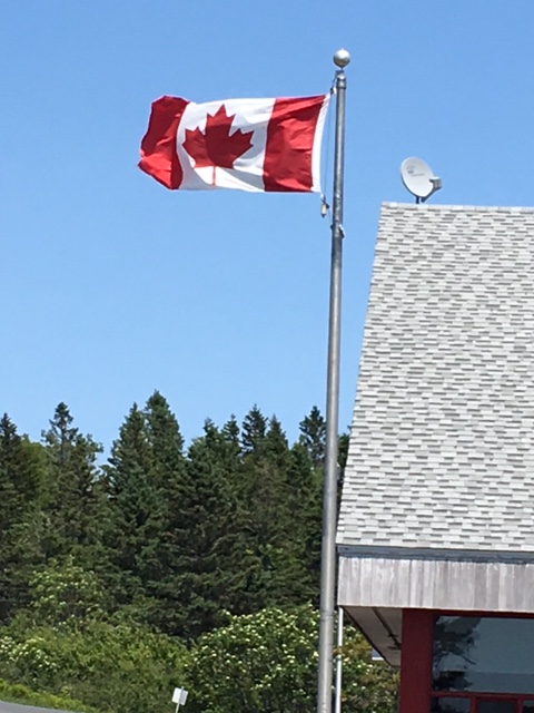
Stretched, chugged water, last-minute porta-a-john use – filled time while awaiting the National Anthem…O’ Canada would be sung today. My second Canadian province in 2 weeks. YES!
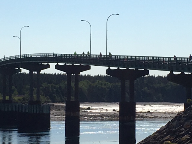
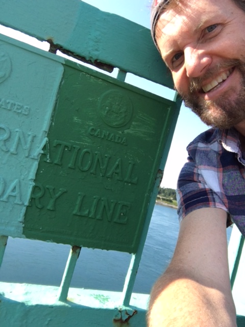
Flat, easy start. 6 miles to Roosevelt Memorial Bridge. Cleared Customs in advance – no drama.
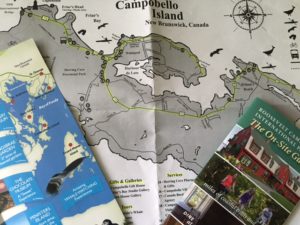
I’d follow the same path as yesterday’s sight-see to Head Harbour Lightstation. Only one east-west route on Campobello…gonna take more than 15 minutes to cross the Island today by foot. LOL>
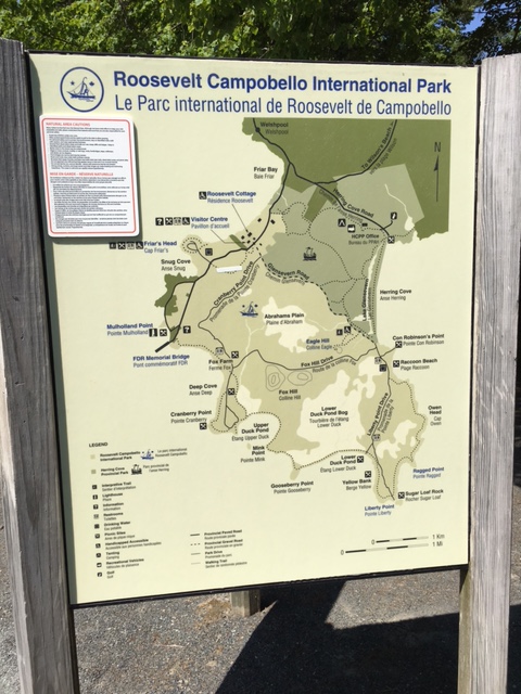
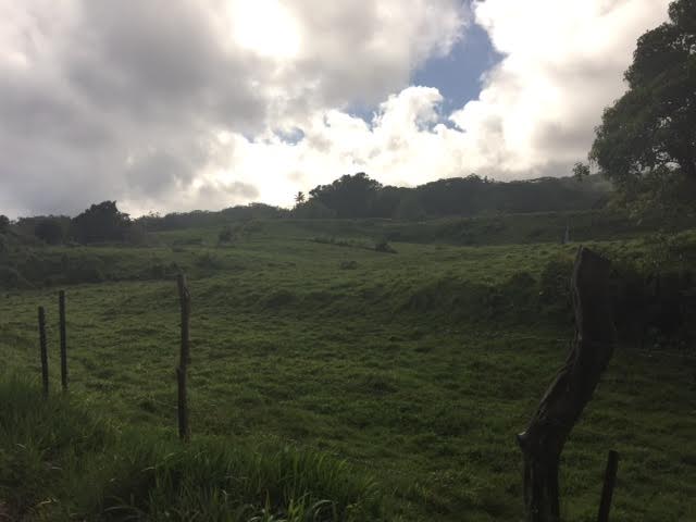
Lotta rolling hills. Find the change in pace suits [me] more than miles of flat pavement. Another beautiful sunshiny day, albeit a bit warmer than yesterday. Roosevelt Campobello Int’l Park, Friar’s Bay, Herring Cove Provincial Park. Stayed on Route 774, kept right & caught much-appreciated shade past Wilson’s Beach. Trekked to the end of Lighthouse Rd – stopped & gazed at Head Harbour Lightstation before water fueling for the return loop to Lubec [pronounced: loo-BECK].
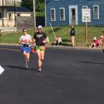
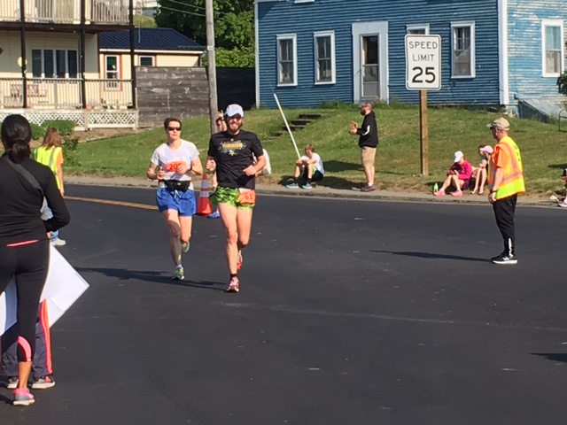
Last 10k, started feelin’ the full morning rays. Slogged a mile+ with 2 early-start 50 Staters. Good mental refresh – LOVE my running community.
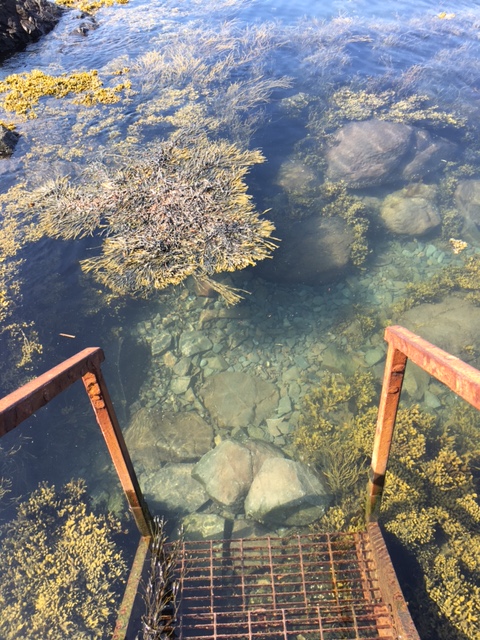
Saw Mulholland Point Lighthouse in the distance (approx 2 miles to go). Up & over the bridge, past the International Boundary Line, US Customs folk cheered as we raced into downtown Lubec toward the Finish.
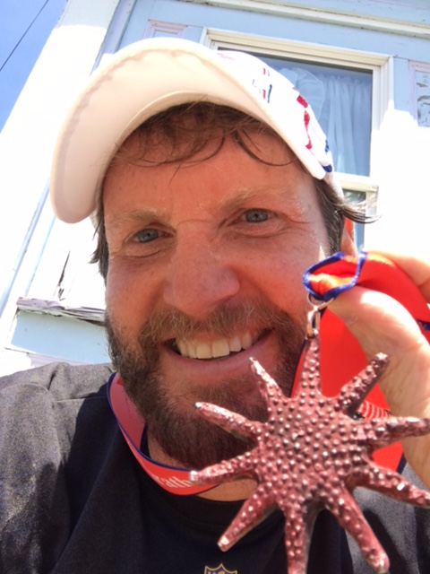
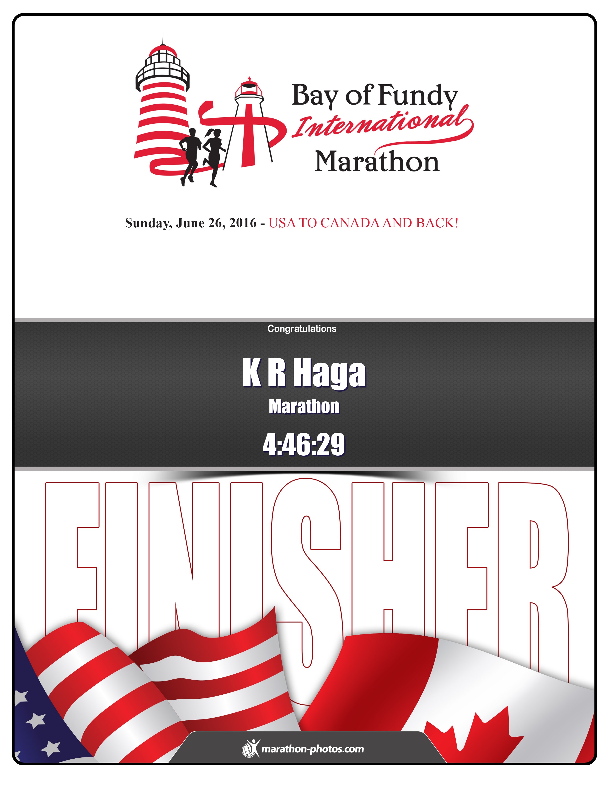
Marathon SUCCESS! Finish Line #66 – 2nd Canadian province, 17th long run of the year (including 3 ultras).
2016 Bay of Fundy International Marathon
Congratulations K R on completing, with a finish time of: 4:46:29.
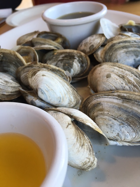
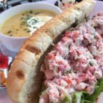
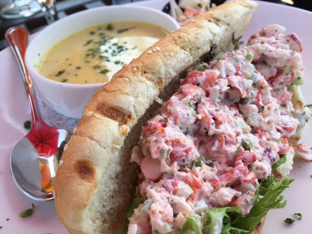
Today’s post-race food reward? Plate of local-catch steamers. FAAANNNTASTIC!
-
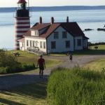
- today’s marathon start at Quoddy Head State Park

-
- mile 6 border crossing
-
- Roosevelt Memorial Bridge
-
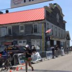
- Finish Line #66

-
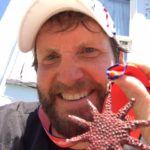
- MEDAL LOVE!
-
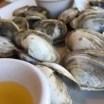
- food reward: plate of local-catch steamers
Campobello Island – pretty exotic name for an island settled by Brits, huh?
Another after-work Friday nite flight. Early a.m. in Manchester NH, grabbed 5 hours sleep, then hit the highway with my friend Stephen – destination: New Brunswick, Canada.
5+ hour trek across all of Maine. Sunny skies, warm summer temps.
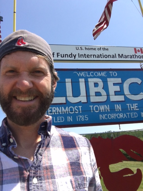
Arrived in Lubec – quick pic at the easternmost town in the US – then 2 miles to FDR Memorial Bridge, our border crossing into Canada. 2 provinces in 2 weeks: Rocky Mtn west [last Sunday], now Atlantic Ocean east. Big grin.
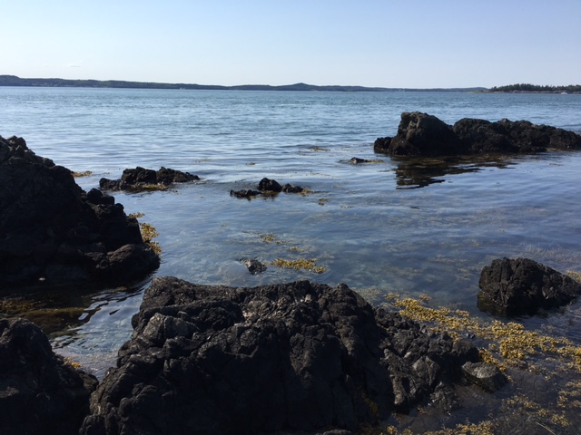
Campobello Island is located in the Bay of Fundy, known for having the highest tidal range in the world. Top of today’s sightseeing list: an ocean walk to Head Harbour Lightstation.
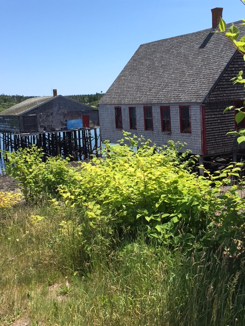
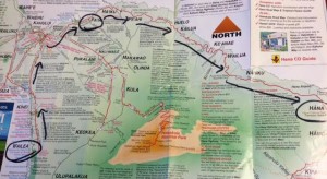
Campobello Island is an island located at the entrance to Passamaquoddy Bay, adjacent to the entrance to Cobscook Bay, and within the Bay of Fundy. The island is one of the Fundy Islands and is part of Charlotte County, New Brunswick, Canada.
The greatest tides in the world occur in the Bay of Fundy…. Burntcoat Head in the Minas Basin, Nova Scotia, has the greatest mean spring range with 14.5 metres (47.5 feet) and an extreme range of 16.3 metres (53.5 feet).
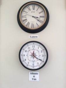
sleeping in US (Eastern), marathoning in Canada (Atlantic)
Visitors Center (maps, restaurant info & sightseeing musts), marathon bib pick-up upon entering New Brunswick & my 2nd Canadian National Park (ya’ll know I’m a FAN).
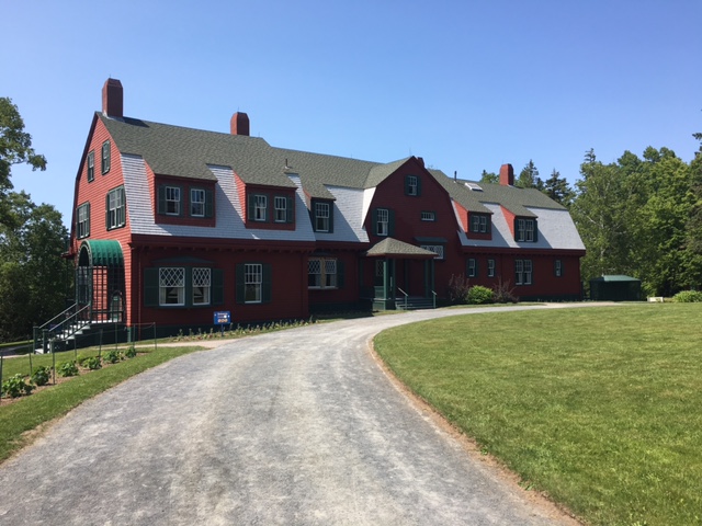
Roosevelt Campobello International Park was created as a memorial to US President Franklin D Roosevelt – whose family built a summer home on the Island. Who knew, right? During my 50 State Quest, visited the homes of Thomas Jefferson & Abraham Lincoln PLUS the Clinton Presidential Library. Never expected to be touring another American president’s home…while in Canada. HA!
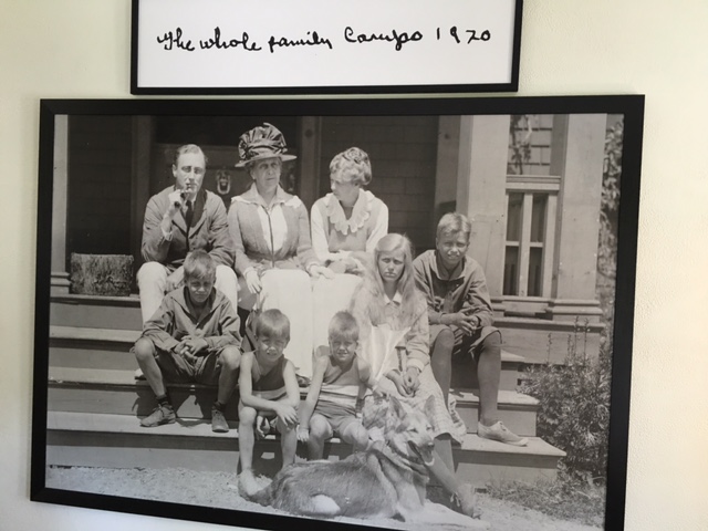
Roosevelt Cottage was over-the-top staffed; knowledgeable guides spouting Roosevelt facts on each floor, in each room. Coming from a middle-class upbringing, didn’t leave feeling a close kinship with Roosevelts – interesting exploring their era though. Talk ’bout lifestyles of the rich & famous. Kinda like the mansion walk in Newport RI; same time period, same old $$.
…it was a nationalistic movement in the 1880’s that turned wealthy visitors away from Europe to spend summers in America. Wealthy people with extensive leisure time flocked to resorts like Newport, Bar Harbor, St. Andrews, and Campobello.
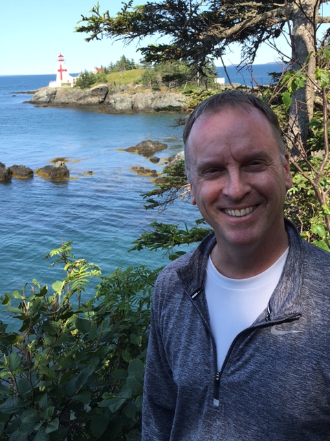
Snagged an oceanview lunch, then travelled to the eastern edge of Campobello — to Head Harbour Lightstation. Unfortunately, missed low tide by several hours. No worries. Soaked in the ocean smell, gazed out across the water. Beautiful day. Lucky in life.
All essential to-do’s checked off the list. I’d see this lighthouse again during tomorrow’s 42.2 🙂
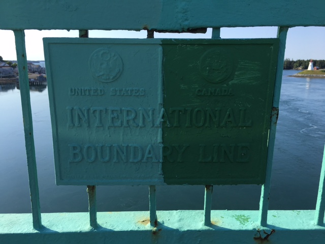
Dinner & lodging accommodations in Maine. Short return drive; east-west only 10 miles of road on this Fundy isle. Snapped a pic at the International Boundary Line.
Sunshine & warm ocean breezes ALL DAY — good one to be a tourist.
-
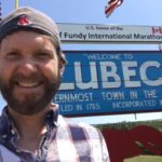
- easternmost town in the USA
-
- O’ Canada!
-
- proud stat: 2 weekends, 2 [Canadian] National Parks
-
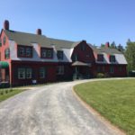
- Roosevelt Cottage – summer home to our 32nd President
-

- the Roosevelts
-
- lunching like a Roosevelt: Passamaquoddy Bay Lobster Roll
-
- Bay of Fundy
-
- ocean walk to Head Harbour Lightstation
-
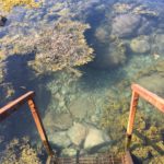
- missed low tide by 7 hours – ho, hum
-
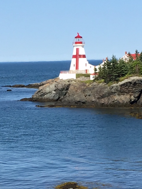
- Head Harbour Lightstation — whole lotta water, no ocean walk today
-
- FDR Memorial Bridge
-
- USA shore: Lubec, Maine

-
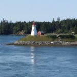
- Canadian side: Mulholland Point Lighthouse

-
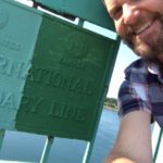
- US-Canada Boundary Line
Campobello Island, New Brunswick
Marathon & volcano hike – top 2 (only 2) items on my Hawaiian adventure list. Being a cold-weather mountain enthusiastic, ran the risk of missing out on everything Hawaiian – island activities just don’t cross my mind (I’m in the 2% world minority 🙂 ). Luckily, many of my friends have been to Hawaii & filled my post-race itinerary with excellent recommendations. Thanks!
 Woke early Monday still feeling a little banged up from the previous day’s marathon, so opted for a sit-down road trippin’ day. With no east-west highway available across Maui’s south shore, headed north toward Kahului before driving east on Maui’s infamous Hāna Highway. Today’s road-trippin’ destination: the Road to Hāna
Stats: 52 miles, 617 curves, 56 bridges, 3 hours
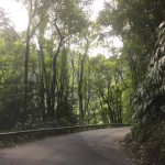
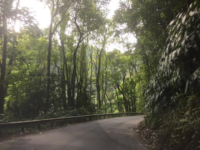
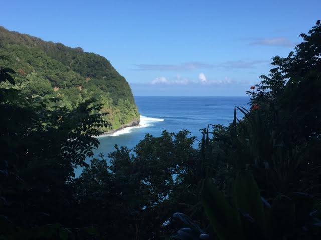
Sandy beaches & the arid landscape of Wailea soon gave way to lush green forest & dark lava-fed soil – exactly what I remember folks talkin’ about on their Hawaii vacations. What folks didn’t talk about was the windy road to Hāna. Scenic – heck yeah – but curvy…worse than California Highway 1. One-lane bridges, the new norm. No visibility; initially you inch around these blind turns hoping a car won’t clip you on the other side. An hour in, you realize that’s why you buy insurance. LOL>
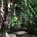
2 hours in, pulled over & hiked Ke’anae Arboretum – short hiking trail thru the tropical forest. Highly recommended.
Back on the road, stopped for lunch in Hāna Bay. Fresh fish, outdoor seating with an ocean view – FAAANNNTASTIC! Stopped in a gift shop to verify I wasn’t missing something historic – nope, nothing else in Hāna…beach & food. Check, got it covered 🙂
-

- lush green forest & dark lava-fed soil
-
- 52 miles, 617 curves, 56 bridges, 3 hours
-
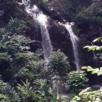
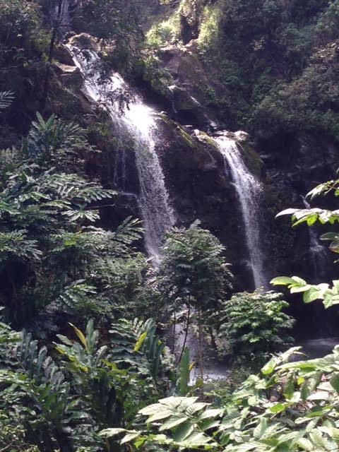
- Twin Falls
-
- Ke’anae Arboretum
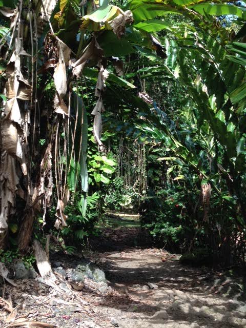
-
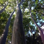
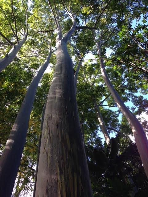
- Rainbow Eucalyptus
-
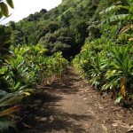
- short hiking trail thru tropical guava groves – highly recommended!

-

- fresh fish, fresh fruit — my 2 Hawaiian faves
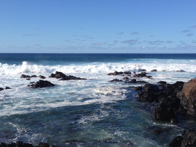
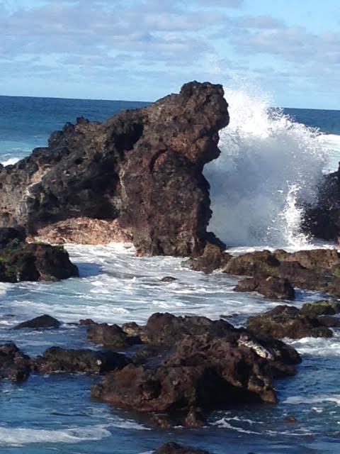
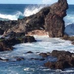
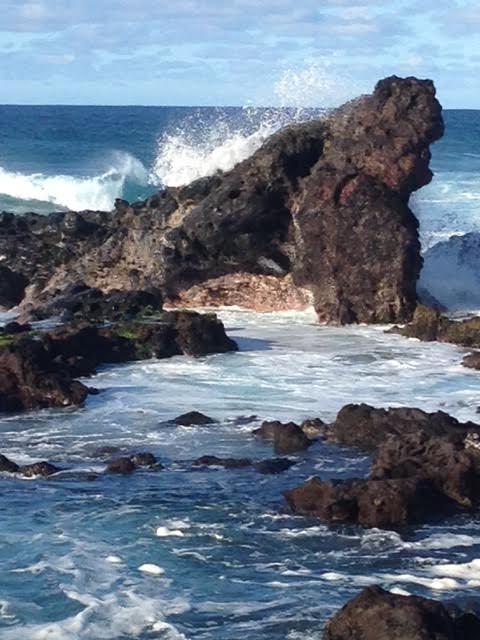
Autobahn’ng the return, stopped to watch the mighty waves of Pāʻia.
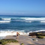
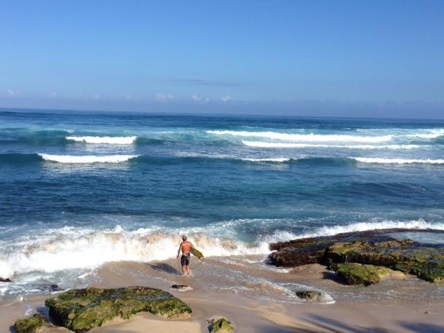
Worked my way down the rocks at Ho’okipa & stared ahead into the aqua blue. Rough surf made for AMAZING 20-foot waves. Ocean smashed over the large volcanic boulders. Sound. Smell. It’s the mighty waves of Pāʻia I’ll remember years from now.
Watched surfers ocean-paddle, incoming wave approach, surfers seemingly disappear, moments later heads break the surface in unison – pop, pop, pop – and the game repeats. Mesmerized, stayed ’til nightfall.
Hawaiian Day 3 over – tomorrow morning, snorkeling Molokini Crater.
-
- WOW WOW WOW!
-
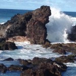
- whatta show — ocean smashed over the large volcanic boulders
-
- mesmerized, stayed ’til nightfall
mighty waves of Pāʻia