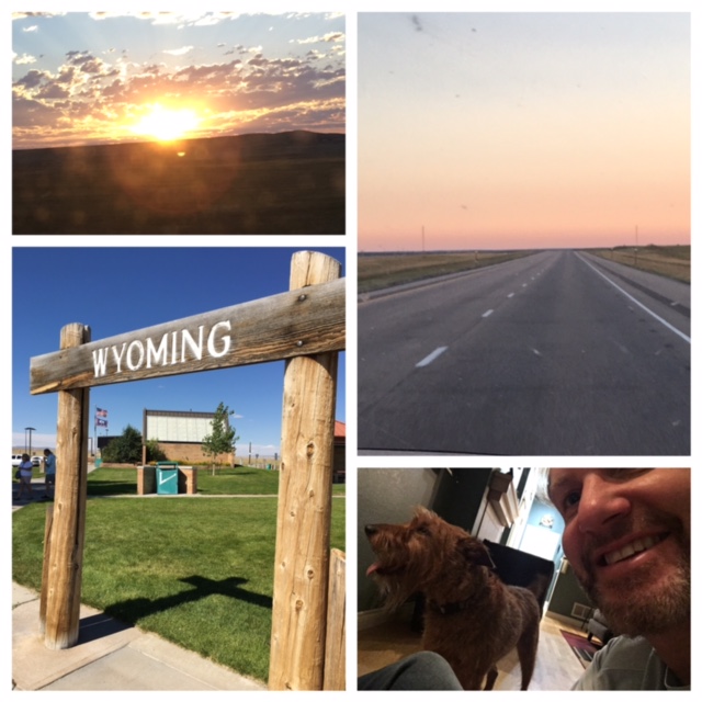
Monday: the first solar eclipse to travel ‘cross the USA since June 1918 (99 years). Totality – FULL eclipse of the daytime sun – not in Colorado, but only 4 hours away in Casper, Wyoming. TOTAL ECLIPSE on my Birthday – it’s a sign, right? This year’s BIRTHDAY CAMPING destination 🙂
Wyoming, America’s LEAST populated state (literally #50, behind Alaska & Vermont). ALL hotels, B&B’s, hostels – EVERY SINGLE ROOM booked, no exaggeration. Paid $35/night (3 months ago) to camp in an open field, private land on Casper Mountain – turned out to be the deal of the weekend!
Past 2 weeks: ECLIPSE, the buzz word in the office/neighborhood/weekly run group/gym.
So many people travelling north to rural Wyoming, news media warning Coloradans to carry food, water, gasoline. Phone carrier bringing in 2 temporary cell towers to handle the volume increase.
Yikes. Do I stay or do I go-go?
Packed, planned accordingly. Left home at 4am Saturday morning.
Wyoming expecting a crush of 600,000 people, most coming from Colorado
Coloradans hoping to catch the Aug. 21 solar eclipse at the last minute shouldn’t count on catching the moment when the sun is blacked out by the moon. Without a strategy to view the once-in-a-lifetime spectacle, they may find themselves stuck in bumper-to-bumper traffic on Interstate 25 instead.
When the sky darkens during the much-anticipated event, it will be the well-prepared who get to enjoy its splendor. Among the key tips: leave early, pack extra supplies and arrange a place to stay ahead of time. Otherwise, risk facing bumper-to-bumper traffic and overcrowded campsites at every turn.
Some are predicting that up to 600,000 people will travel to Wyoming (2016 population: 585,501), hoping to squeeze into the 67-mile wide swath of darkness — known as the totality — that will cut across the state that morning, according to the Colorado Department of Transportation.
About two-thirds of those visitors are expected to flood into Wyoming from the south, putting an incredible stress on roads like I-25, which normally accommodates about 83,000 vehicles a day, CDOT spokesman Jared Fiel said.
“When we’re talking about adding that many more people to the roads, it’s going to be intimidating,” Fiel said. “We are fully planning for it be pretty bad. The earlier you can get up there, the better because we really don’t know what’s going to happen.”
Traffic and finding a perfect campsite aren’t the only inconveniences in the run-up to the eclipse. Cell phone service may also be hard to come by.
“Certainly the cell towers in Wyoming weren’t meant to handle that situation,” CDOT’s Fiel said, suggesting travelers bring walkie talkies.
Not a soul on the highway at 4am. Watched the sunrise just past Chugwater. Antelope grazed where one normally sees cattle. Breakfast’d in downtown Casper, then claimed my campsite 20 minutes away on Casper Mountain.
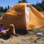
10:22am. Tented, dog walked/fed/water’d.
No plans today [hike day tomorrow] – honestly, thought I’d still be in traffic. Google-search’d nearby OUTDOOR activities.
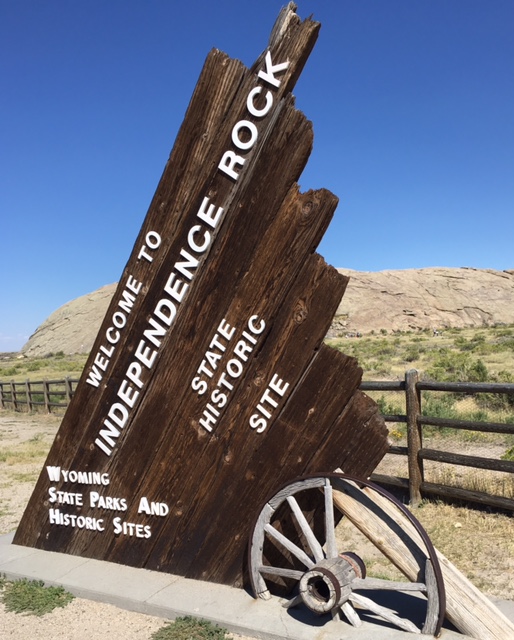
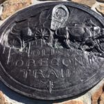
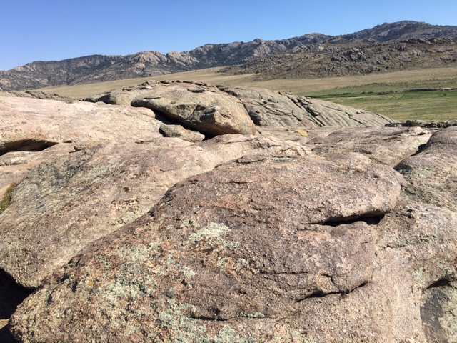
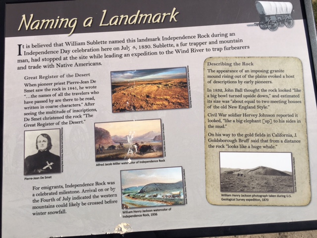
Independence Rock: 40 minutes west, HISTORICAL, dog-friendly. Check, done 🙂
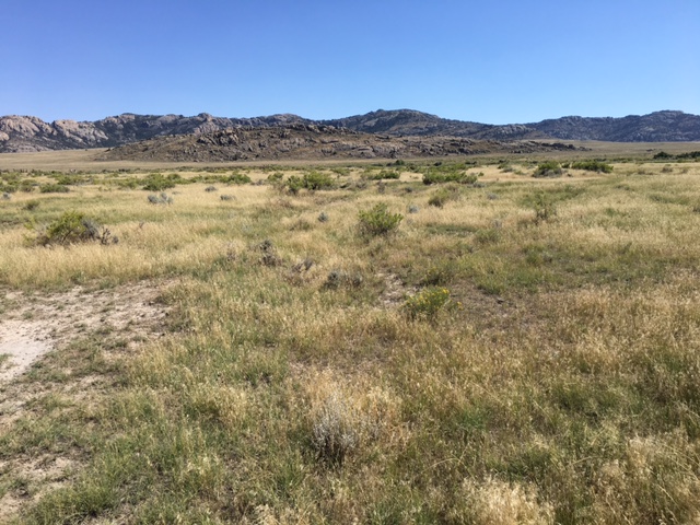
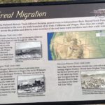
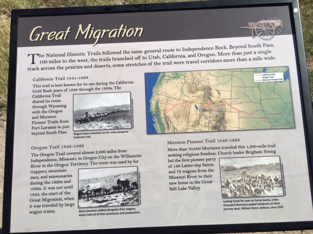
Dry grass-sparse ranch land, Casper to Alcova. mid-1800’s, three National Trails crossed Independence Rock: Oregon Trail (infamous Missouri to Oregon trek), California Trail (Gold Rush of ‘49) & the Mormon Trail (Brigham Young migration to Utah).
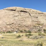
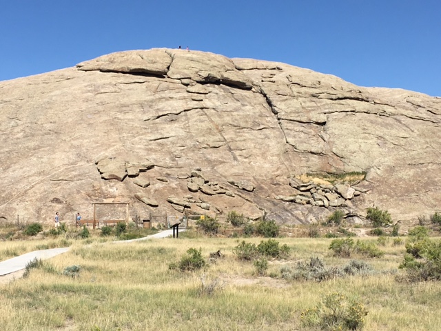
Independence Rock, first blip on the prairie since Casper. Going UP? Absolutely! Not remotely technical – first glance looked like an impossible climb, no more than a moderate hike. Rainwater pooled in naturally-eroded cracks on the Rock’s surface.
For emigrants, Independence Rock was a celebrated milestone. Arrival on or by the Fourth of July indicated the western mountains could likely be crossed before winter snowfall.
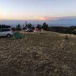
Back on Casper Mountain, past few hours/campsite had grown into a community – joined by another 30-40 RVs/tents. Sunset, temps dropped. First night’s meal: crab cakes, polenta & kale (pan warmed/previously prepared). Not bad for camping, right? ❤
-
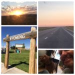
- Welcome to Wyoming!
-

- dry grass-sparse ranch land
-
- Oregon, California & Mormon Trails
-
- Great Migration of 1843

-
- Going UP? Absolutely!
-
- 19th century description: “unfit for human habitation” “The Great American Desert”
-
- Independence Day 1830
-
- ‘eclipse’ camping
-
- SUNSET

-

- not bad for camping, right?

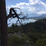
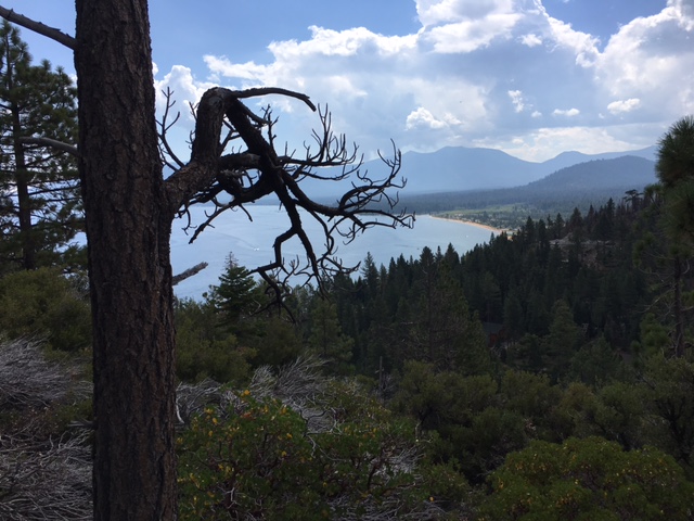
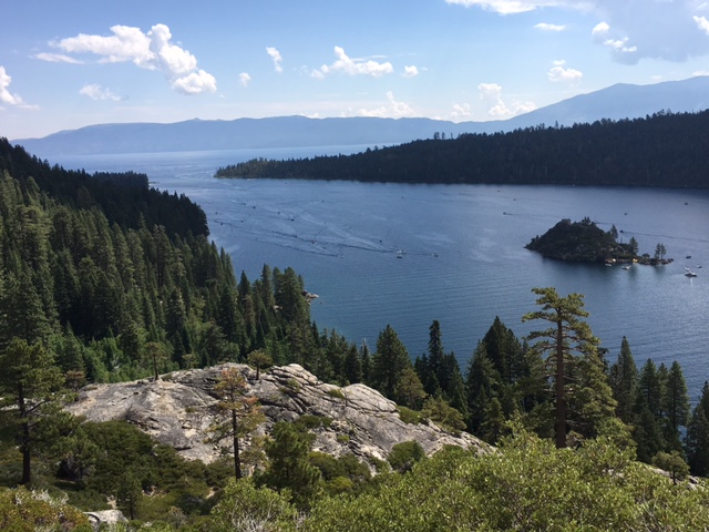
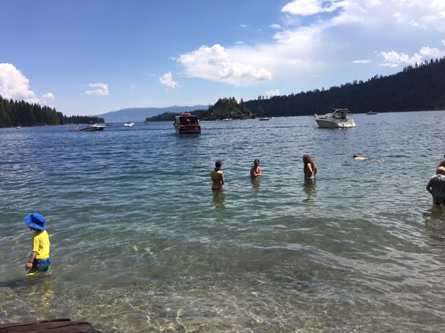
Yesterday in the high Sierras, today on scenic Lake Tahoe.
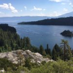
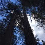
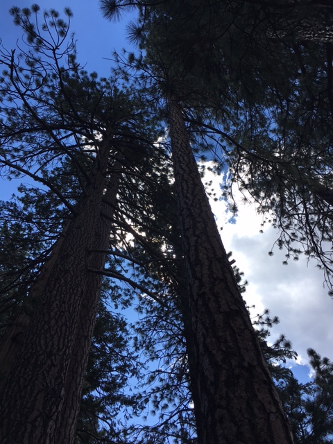
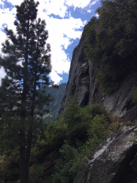
Sunrise woke in South Lake Tahoe, circled the lake northward – day’s first stop: Emerald Bay. Mix of tall redwood & pine – HUGE evergreen – line California’s largest freshwater lake. Bay tinted green (emerald green) where it hugs shore.
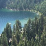
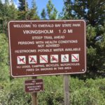
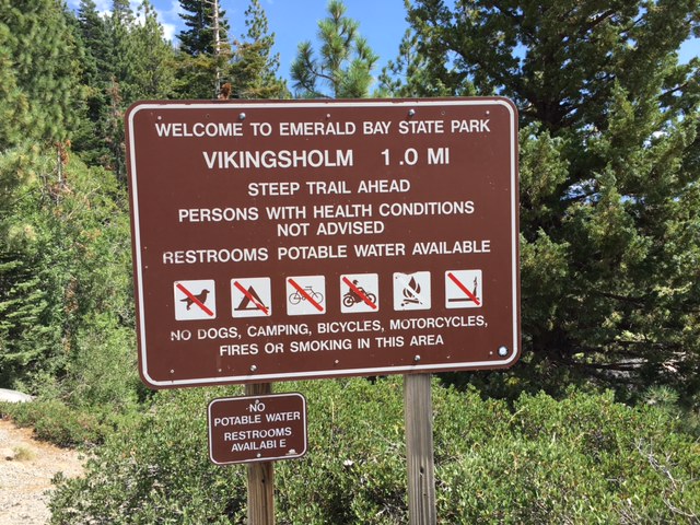
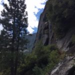
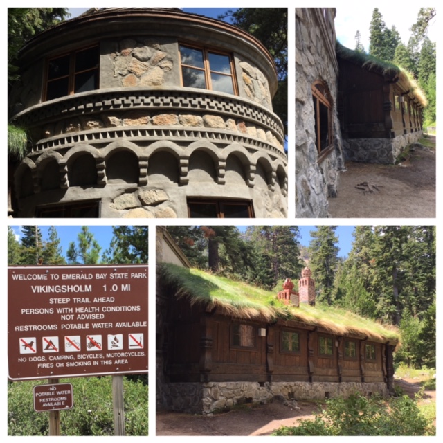
$10 to the Park Ranger. Successfully secured parking (kinda a big deal in California). Stared long/hard at the Lake horizon, before starting the short steep hike DOWN to Vikingsholm on tourist-heavy Tahoe – HIKE day ❤
Vikingsholm…this magnificent “castle” is a unique blend of nature’s spectacular beauty and man’s architectural ingenuity.
The Vikingsholm foundation was laid in 1928, but the building was constructed in 1929 by 200 workers. Vikingsholm was built by Mrs. Lora Josephine Knight as a summer home. Before starting construction, Mrs. Knight and her architect traveled to Scandinavia to gather ideas for the construction of the house. Some parts of the structure contain no nails or spikes, as a result of old-fashioned construction methods. Most of the building was made from materials found at Lake Tahoe.
Mrs. Knight is best known for building Vikingsholm, but she and her husband Harry, a businessman were primary backers of Charles Lindbergh’s non-stop solo flight across the Atlantic in 1927.
Followed the steep one-mile path DOWN DOWN DOWN to Vikingsholm.
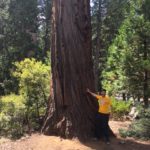
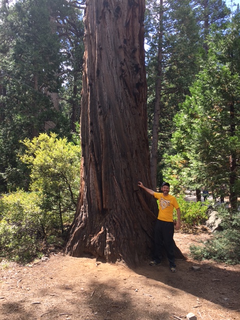
White granite canyons, HUGE forest’d trees. Snagged 2 enormous pine cone for my Colorado mantel.
Interesting well-preserved residence, Vikingsholm, but didn’t purchased a ticket to tour inside. I trail-hiked DOWN to see California redwood, to enjoy the all-consuming scent of pine. Not disappointed, WOW!
Dipped both hands into Lake Tahoe before trekking back UP. UP UP to Hwy 89, the local northbound highway I’d travel lake-circumference. Tahoma, Tahoe City, then lunch. 3 more hours to play ‘til my return flight home from Reno.
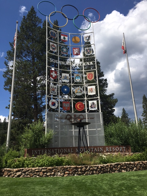
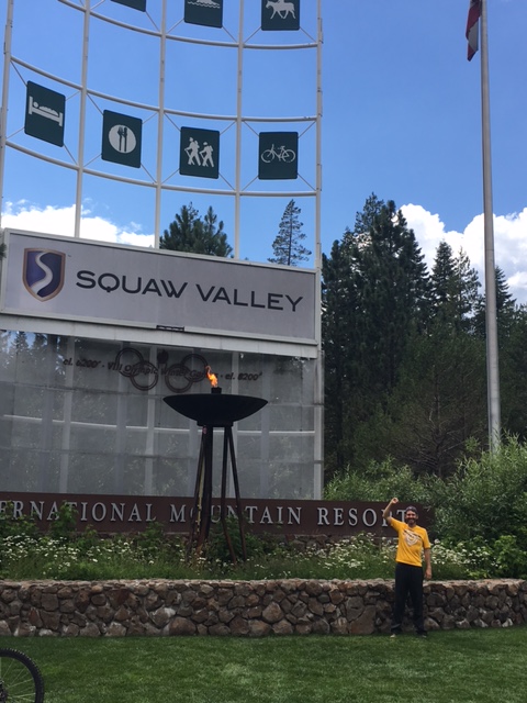
89 North to Truckee, diverted left on Squaw Valley Road.
Squaw Valley, California – site of the 1960 Winter Olympics. Gotta/hafta/must STOP, right? Team USA won first-ever hockey GOLD; Americans [David Jenkins & Carol Heiss] topped both figure skating podiums.
The Games’ spirit, the OLYMPIC FLAME stays lit 24/7, 365 days/year. Pretty neat. I was here.
-
- Emerald Bay State Park
-
- Hwy 89 North to Truckee
-
- marathon’d near snowline yesterday, BEAUTIFUL August landscape!
-
- California’s largest freshwater lake
-
- ’emerald’ green Emerald Bay
-
- steep yet MUCH shorter than yesterday’s 30.5-mile trek
-
- HUGE evergreen
-
- HIKE ❤
-
- California REDWOOD
-
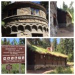
- Vikingsholm (Scandinavian architecture, circa 1929)
-
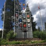
- 1960 Winter Olympics
-
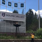
- flame burns 24/7
-

- HOME, sweet Colorado HOME 🙂

After a weekend off from marathoning, back on the trail – literally.
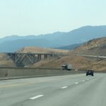
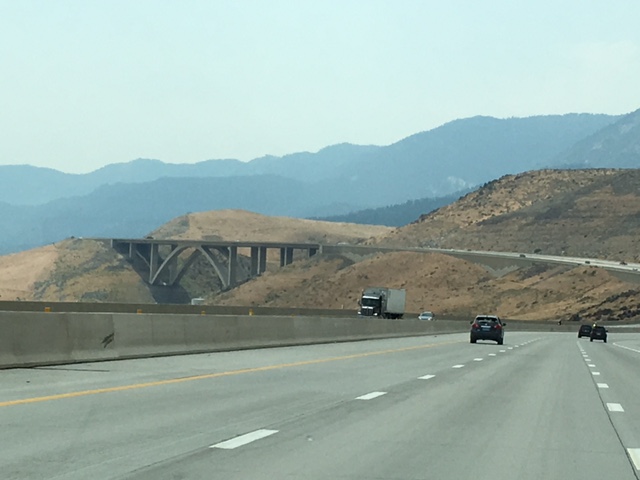
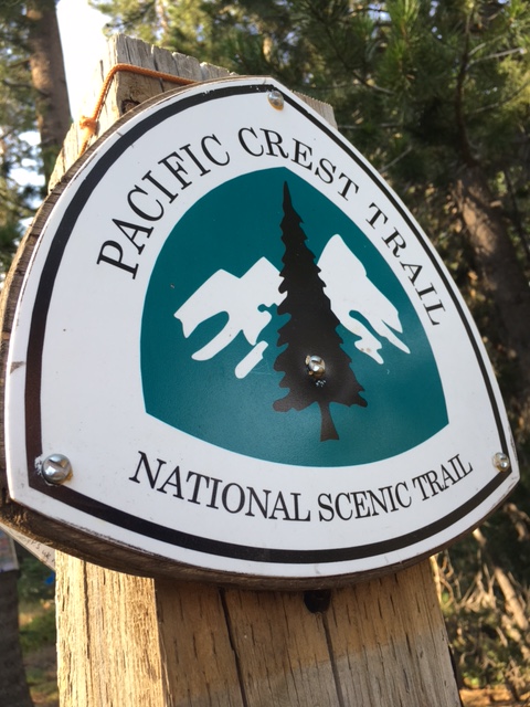
Friday a.m. flight to Reno, scenic hour-half drive to South Lake Tahoe. Running on 2 historic trail systems tomorrow – the PCT (Pacific Crest Trail) & XP (Pony Express) trails in California’s Sierra Nevadas.
Easy laid-back drive, radio set to classic 70’s – never turned the dial, all weekend.
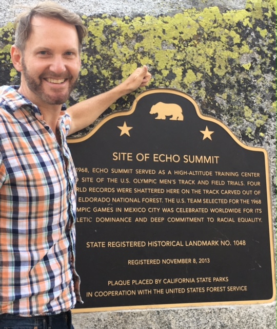
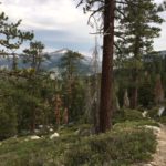
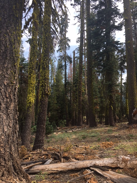
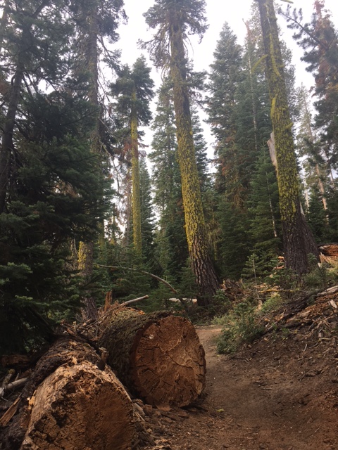
Hotel check-in, then a rural 45 minutes on US 50 West to Kyburz (bib pickup). Located tomorrow’s trail Start at Echo Summit (1968 US Olympic high-altitude training center). Quick hello/goodbye. Back in the morning California redwood, Ponderosa pine ❤
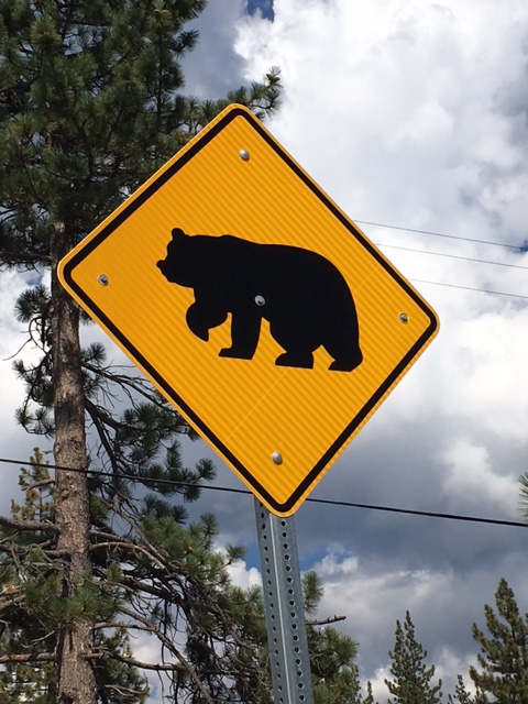
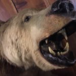
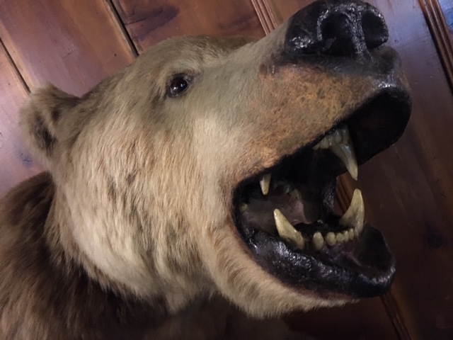
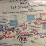
First year event – read & re-read the course description PLUS snapped a shot of the map itself (nothing left to chance). More concerned being lost in the high Sierras than any wildlife encounters (only bear I saw/stuffed at Strawberry Lodge).
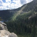
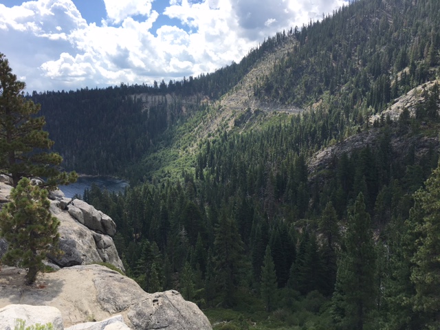
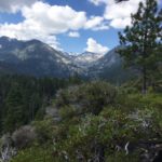
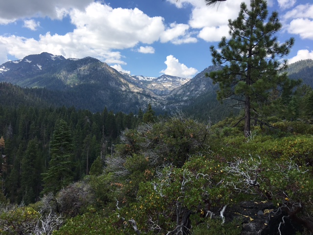
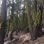
RACE DAY, SATURDAY: Cool & overcast. Mix of HIGH CLOUDS & MASSIVE TREES. Super thankful, appreciated the cover.
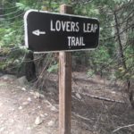
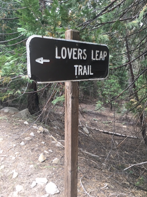
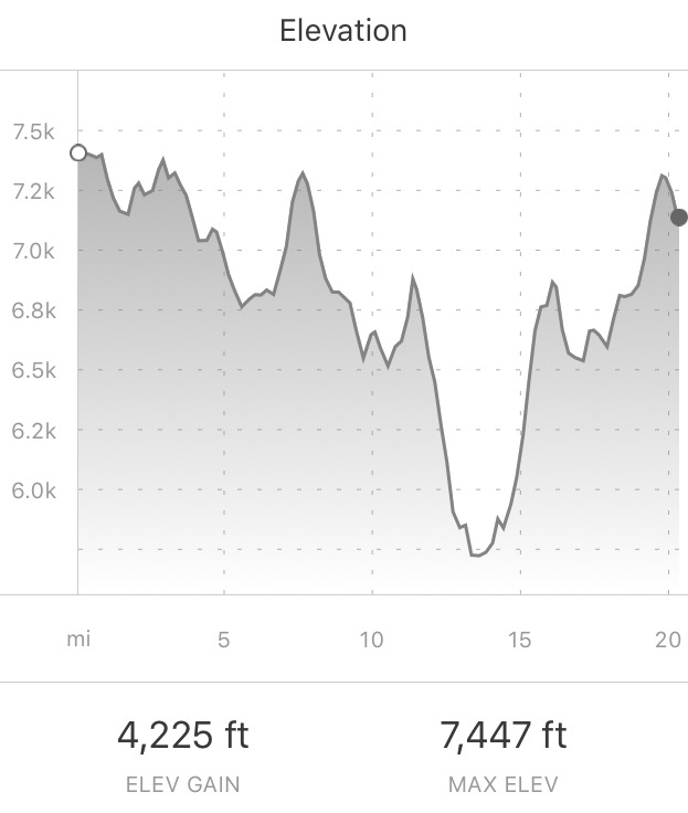
Most of the day, focused/eyes alert for PINK ribbons. 13.8 miles in, started the climb UP. Two HUGE hikes, over 4000ft vertical gain. Lovers Leap Trail: let’s just say, I know why they leaped. Crazy difficult hike.
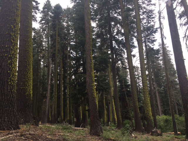
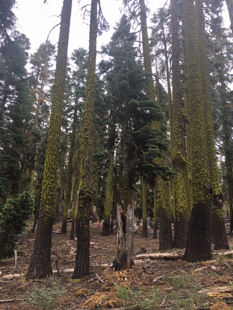
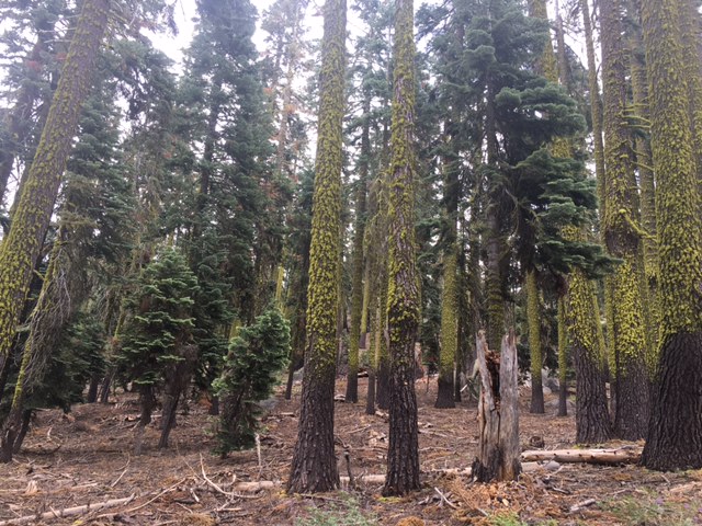
but…the Panorama? (like being) Wrapped inside an Ansel Adams photograph. Just WOW! Every north-facing tree blanketed in vibrant green moss. Yellow-green: closest colour match in my Crayola box. That’s the memory I’ll take home to Colorado.
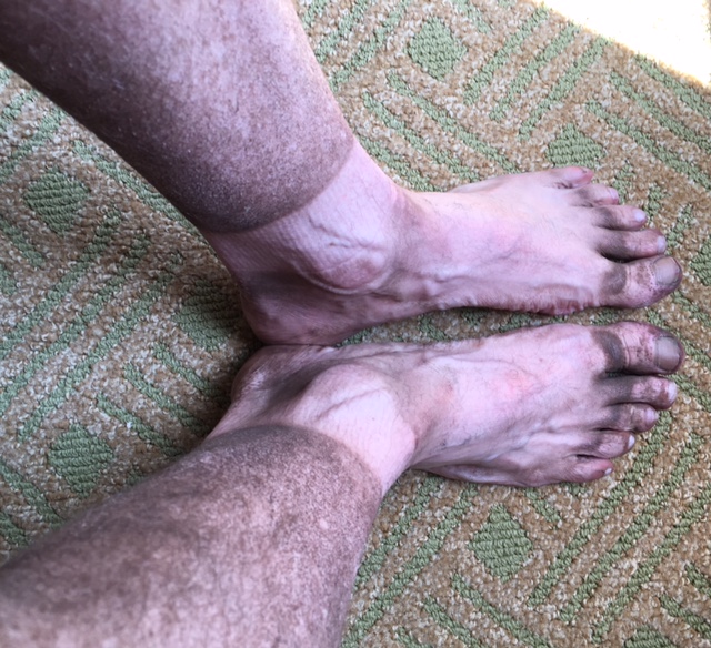
Only negative? Course went long. I know, I know, it’s trail. Folks: this course went long. My watch (& Strava app) died somewhere after 30.5 miles – my first ultra finish of 2017. (I say first ‘cause I haven’t yet given up on running a 50-miler this year.)
#94 in the books. 2nd longest [amount of time] I’ve been on my feet (behind 2013’s Barr Trail hike UP Pike’s Peak).
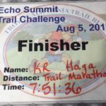
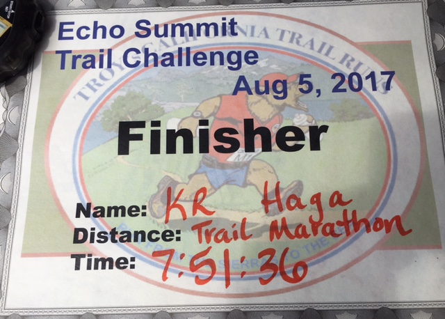
TROY’S CALIFORNIA TRAIL RUNS
Echo Summit Trail Challenge – August 5, 2017
Trail Marathon Jude Archie M 06:40:28 1
Trail Marathon HAGA K R M 07:51:36 2
HIKE DAY tomorrow ‘round tourist-friendly paradiso, Lake Tahoe. Living well, lucky in life 🙂
-
- road-trippin’: Reno to Tahoe
-
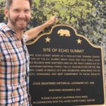
- tomorrow’s trail Start

-
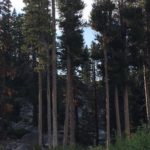
- Ponderosa pine
-
- marathon bib pickup: Strawberry Lodge, Kyburz CA
-
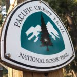
- bucket-list hike, California to Canada
-
- like an Ansel Adams photograph

-
- focused/eyes alert for PINK ribbons
-
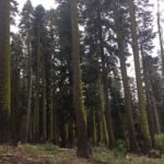
- every north-facing tree covered in vibrant green moss
-
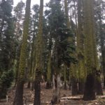
- yellow-green: closest colour match in my Crayola box
-
- FAAANNNNTASTIC!

-
- crazy difficult climb: let’s just say, I know why they leaped
-
- watch died somewhere after 30.5 miles – my first ultra of 2017
-
- marathon #94

-
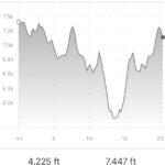
- over 4000ft vertical gain
-
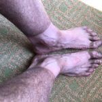
- 30.5 miles of TRAIL
-
- 2nd longest I’ve been on my feet
road-trippin’: Reno to Tahoe