2 ½ months ‘til my 2017 challenge – BIGHORN.
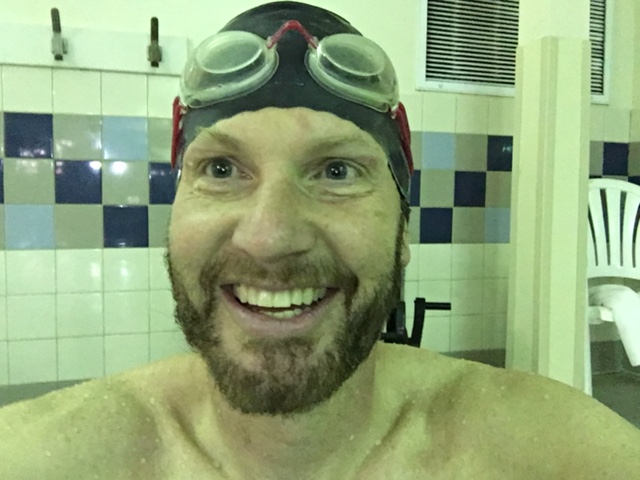
100+ consecutive run days, 100 miles+ ahead for the year. Kicked it up another notch – just added swimming. Not a fan of early morning water, but pulling out all stops this year…no excuses, nothing undone.
10K morning – 6 mile run, quarter-mile swim. Increasing lung capacity, lengthening my stride, strengthening mind & body. Marathoning 5 of the next 6 weekends (Colorado, Oklahoma, Canada & New Hampshire).
June 17th: BIGHORN TRAIL RUN. 52 miles of trail – at altitude, north on the Wyoming/Montana border. Won’t be physically strong enough by mid-June, counting on mental strength to gut thru the day.
Nutrition. Have yet to solve the riddle, [expecting a] 15 hour run day. Must learn to eat while running – or I’m doomed.
-
- 6 mile run, quarter-mile swim
-

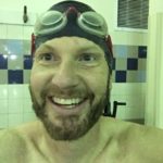
- LOVE LOVE this face!
Bighorn Trail Run 52m
Course Elevation at the Start: 8800 feet
The 52 mile course begins at Jaws Trailhead and proceeds easterly on trail approximately 1.5 miles where it crosses Forest Service Road #14 (Devils Canyon Road). At this point, the trail joins trail #50 (Little Horn Trail) and starts to descend into the Little Horn drainage. Here is where you start your adventure on the original Little Horn Trail #50. The trail crosses several small creeks as you drop into Willow Creek then Duncum Creek drainage. Panoramic views and splendid seas of wildflowers greet you as the trail descends into the Wagon Box drainage.
After dropping about 1000 feet in 8 miles SPRING MARSH Aid Station #1 awaits your arrival. The supplies are limited there as it is accessible only by foot, so all supplies have been packed in. As the trail descends the Little Bighorn Canyon to Leaky Mountain Creek you might notice a sign about 150 yards after crossing Leaky Creek. At this sign turn and look to your left and you’ll see why it was appropriately named Leaky Mountain. As you descend deeper into the canyon excellent views are afforded of the lower parts of the Little Bighorn Canyon and the confluence of the Dry Fork Canyon coming in from the south. Another limited aid station called THE NARROWS Aid Station #2 at 5500 feet and 15 miles into the course is awaiting your arrival.
Continuing down to the FOOT BRIDGE Aid Station #3 at 18 miles and 4200 feet you’ll find your drop bag at the fully equipped aid station. It is advisable to have dry socks and shoes in your drop bag here. After crossing the Foot Bridge, you begin a major climb up the Dry Fork reaching BEAR HUNTING CAMP Aid Station #4, a limited aid station at mile 21 1/2 and approximately 6300 feet. The course then levels off slightly to the KERNS COW CAMP Aid Station #5 at 28 miles and approx. 6800 feet. This is the course junction where you join the 50 Km course. You’ll continue on together climbing up to the HEAD OF THE DRY FORK Aid Station #6 at mile 34 and approx. 7650 feet. This is your second and final drop bag cache.
After leaving the aid station the course proceeds up the Freeze Out road, following trails and a gravel road cresting on Camp Creek Ridge at 8,100 feet. It then descends down Sheep Creek drainage to 7,300 feet on a four-wheel drive road. After running about 5.5 miles from the Dry Fork station you will reach the fully supplied UPPER SHEEP CREEK aid station (39 Mile Checkpoint). Next is the summit of Horse Creek Ridge at 8,000 feet, following trails and primitive four-wheel drive roads, which will then drop you into Tongue River Canyon. Take a moment to view the canyon and the distant plains before you descend the trail through seas of wildflowers.
LOWER SHEEP CREEK aid station at mile 44 1/2 and 5025 feet, is a good place to fill your bottles before entering the sometimes hot canyon below. Continuing on to the TONGUE RIVER aid station at mile 46 1/2 and approximately 4225 feet you will leave the trail and run on a relatively flat gravel road for the remainder of the distance. At about mile 49 is the final aid station, HOMESTRETCH aid station. Continue on and just as you are entering Dayton you will cross the Tongue River on a rustic footbridge. Runners then cross Highway 14 and proceed into town making a left onto 3rd street. Go one block and make a left onto Broadway and into Scott Park where the FINISH and picnic gala await you.
Brian Morrison, Western States 100 – ‘bucket list’ endurance race


Leave a Reply